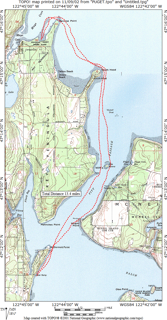
Pitt Island and Penrose State Park
|
Pitt Island and Penrose State Park |
|
|
| Launch Point | |
| Max Difficulty: | SK I/II |
| Paddle Length/Time | 13.4 nm/ 15.4 / 5 hrs |
| Tide/Current Station | Longbranch, Filucy Bay & Home, Carr Inlet / Pitt Passage (ebb flows NNE) |
| Destination | Penrose State Park |
| Description | Launch from from the boat ramp at the end of 72nd Street. Paddle north along Filucy Bay and on past Pitt Island (Indian Burial Ground, no landing permitted) and along the shoreline to Penrose State Park for a mid-point rest stop. The return trip is back down the coast line enjoying the view of Mt Rainier. Use the current through Pitt Passage to make this paddle easier, the current can reach speeds of at least 1.7 kts. |
| Back to South Sound Paddle Map | Return to Kayak NW Home Page |