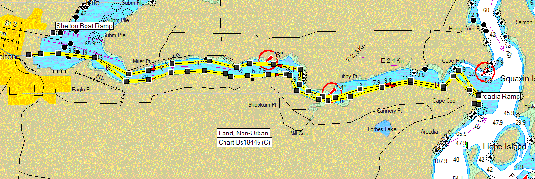
| Launch Point |
Arcadia <Click
Here for a Google Map> |
|
Max Difficulty: |
SK V for currents |
| Paddle Length/Time |
14.6 nm / 16.8 sm / 5
hours |
| Tide/Current Station |
Arcadia / Libby Pt
(1881) & Skookum Pt (1886) |
| Destination |
Shelton |
| Description |
Plan on a full day
paddling. You must look at the current charts prior to
paddling through Hamersley. The current can attain a flow rate
of 4.4+ kts. Plan on going in on the flood your skill level should
determine the amount of current you can handle. The paddle in
can be quiet pleasant especially with a good push. Plan on
having strong currents at the choke points, the rest will be
relatively placid. Enjoy the view and keep your eyes out for
boats since this is a narrow inlet. You have 2 choices for
landing at Shelton. There is a Boat ramp nw of town, its
approximately a .5 mile hike into town. the other option is to
paddle up the creek as shown on the map above. At high tide
you can paddle all the way to the highway 3 bridge. there is a
small sandbar where you can exit the boats, we were able to
park 4 kayaks there. It is a bit of a climb up the bank.
The Pine Tree, at 1st and 3rd, has a great breakfast and
atmosphere!! |
| Back to
South Sound Paddle Map |
Return to Kayak NW
Home Page |