|
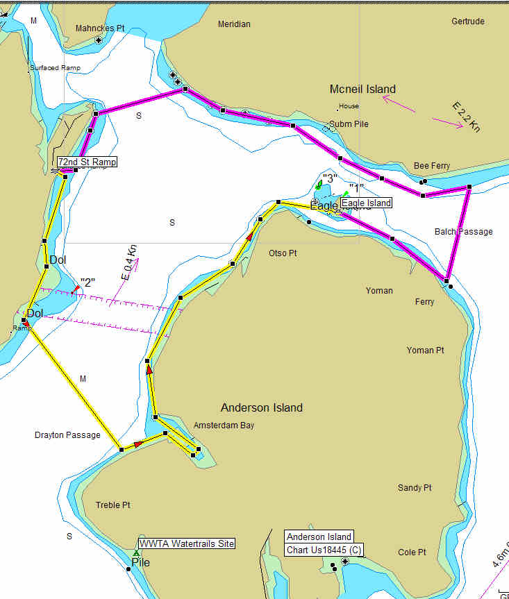
72nd Street to Eagle Island |
|
|
|
72nd Street to Eagle Island |
|
|
| Launch Point | |
| Max Difficulty: | SK I/II |
| Paddle Length/Time | 11.9 nm/ 13.7 / 4+ hrs |
| Tide/Current Station | Longbranch, Filucy Bay & Yoman Point / Balch Passage (ebb flows E) |
| Destination | Eagle Island |
| Description | Launch from from
the boat ramp at the end of 72nd Street. Paddle south along
the peninsula exploring the coast line. Cut across to Anderson
Island exploring Amsterdam Bay and on north exploring the shore
until you reach Eagle Island. Stop here for a picnic or just a
rest stop. You can hear the currents west of the island when
they are changing...do your planning currents can reach speeds of up
to 2.4 kts.
Eagle Island State Park has no camping and no facilities on shore, there are 3 mooring buoys. When the waters are choppy, the moorage can get a little rough, but the scenery is lovely. It's also a popular lunch stop. Be very quiet and you'll probably see several harbor seals pop up, as curious about you as you are about them. The beach is pleasant and smooth, but be careful, there's poison oak amongst vegetation farther inland. Paddle on after your rest stop heading east along Anderson Island and then across to McNeil Island. Remember McNeil is a state prison!!! No landing allowed. Keep at least a 1000 ft off shore as you paddle back west along the shore. Crossing Pitt passage back to the 72nd Street Ramp. |
| Back to South Sound Paddle Map | Return to Kayak NW Home Page |